
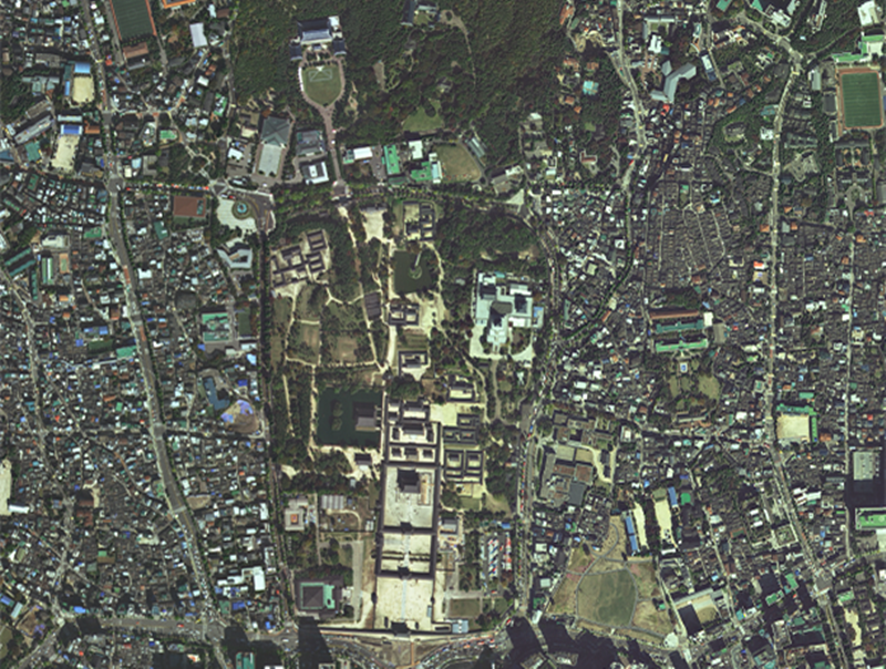
This photo taken by Compact Advanced Satellite 500-1 (CAS500-1) shows the area around Gyeongbokgung Palace and Cheong Wa Dae in Seoul’s Jongno-gu District. (Ministry of Land, Infrastructure and Transport)
By Israa Mohamed
The National Geographic Information Institute (NGII) under the Ministry of Land, Infrastructure and Transport on Oct. 18 said Compact Advanced Satellite 500-1 (CAS500-1), the country’s first domestically developed land observation satellite, marked its second anniversary of operations.
Launched on March 22, 2021, from the spaceport Baikonur Cosmodrome in Kazakhstan, the satellite went fully operational on Oct. 18 that year.
CAS500-1 orbits Earth 15 times per day at an altitude of 500 km and takes photos of the Korean Peninsula and other areas of interest in Korea and abroad. Over the past two years, it has made about 14,000 revolutions.
High-resolution observation images from CAS500-1 are used for purposes like compiling spatial data on restricted zones for aerial photography, supporting official development assistance projects, and help for disasters at home and abroad.
The institute said the satellite’s annual economic value was an estimated KRW 48.5 billion as of last year based on unit sale prices of images from foreign satellites and image distribution by CAS500-1.
NGGI Director General Cho Woo-seok said, “We pledge greater efforts toward disseminating and utilizing high-resolution satellite images by continuing to produce and service high-quality satellite data through stable operations of CAS500-1.”
ess8@korea.kr


