By Kim Yeojin and Yoon Sojung
Video = Official YouTube account of Korea.net
A new section on a tourist path in the Hantangang River valley of Gangwon-do Province, a region designated a UNESCO Global Geopark, has been opened to the public.
The Ministry of the Interior and Safety on Nov. 17 said it officially opened a 3.6-km route on the river, mainly in Cheorwon-gun County, as part of a project for building a columnar joint road.
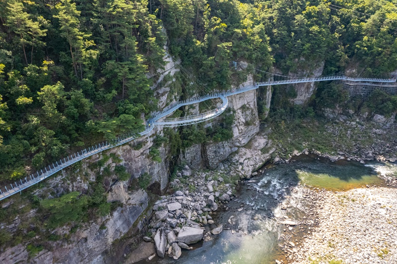
This plank path was built in July last year along the cliffs of the valley by installing a ladder-shaped bridge.
Cheorwon Hantangang Columnar Joint Path is a walking path made by installing a small bridge between the cliffs and the cliff that hangs high as a ladder. The Hantangang area was designated a UNESCO Global Geopark in July last year.
With three observatory spots and 13 bridges, the new path offers a much closer view of the cliffs while hiking.
The section has offers free admission.
The river was created 50,000 to 100,000 years ago by hot lava that flowed from Orisan Mountain in present-day North Korea. Thanks to its well-preserved volcanic topography including columnar joints and pillow lava, the Hantangang area saw a large section covering 1,165.61 km designated a UNESCO Global Geopark.
The ministry and provincial authorities have pursued a joint project to create a 121-km tourist route of the columnar joint. The objective is to connect an existing 78-km route to one spanning 43 km that was severed. After opening the new path in Cheorwon-gun, both sides plan to gradually open in Gyeonggi-do Province a 9.3-km route in Yeoncheon-gun County and a 30.1-km route in Pocheon.

This is the newly opened section of a columnar joint road in the Hantangang River area in Cheorwon-gun County, Gangwon-do Province. (Cheorwon-gun County)
lvzhen@korea.kr


